Measuring Freshman Hill's Steepest Point
By: Jennifer Herseim Map courtesy of Georgia Tech Infrastructure & Sustainability Office | Categories: Featured Stories
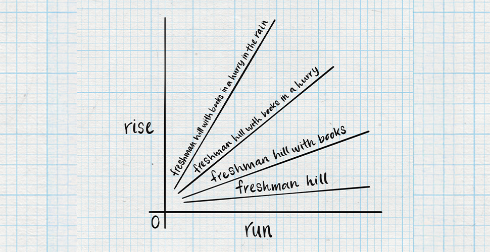
A recent graphic of Freshman Hill's notorious slope and conditions that can make each step feel like an extra slog spurred many Yellow Jackets to ask: What is the steepest point of Freshman Hill? While the average slope is 5.3%, a social post recently generated hundreds of comments from skeptical Yellow Jackets ready to pull the official GIS data to refute the results.
"5.3%? As I remember, it was much steeper than that," commented Louis Kanellos.
"Seems like a higher angle than that," added Marilyn Smith.
"Seems pretty flat compared to how I remember it. Are you sure of that stat? Has the CE dept. verified?" wrote Eric Pilcher.
The Alumni Magazine turned to topographical sleuths Jason Gregory, the Institute's Landscape Architect, and Kelsey Abernathy, Enterprise System Analyst (GIS), both from Tech's Infrastructure & Sustainability office, to solve the case.
"Everyone's favorite question...slope = rise/run," says Gregory. "The steepest section is between Fowler St. (elevation 930') and Cherry Street (elevation 975') at the library. This is a 500' section of road, resulting in a 9% slope." There you have it.
Freshman Hill Elevation Map
Explore the elevation of Freshman Hill (or just relive the climb) using this Point Cloud map made by Kelsey Abernathy.